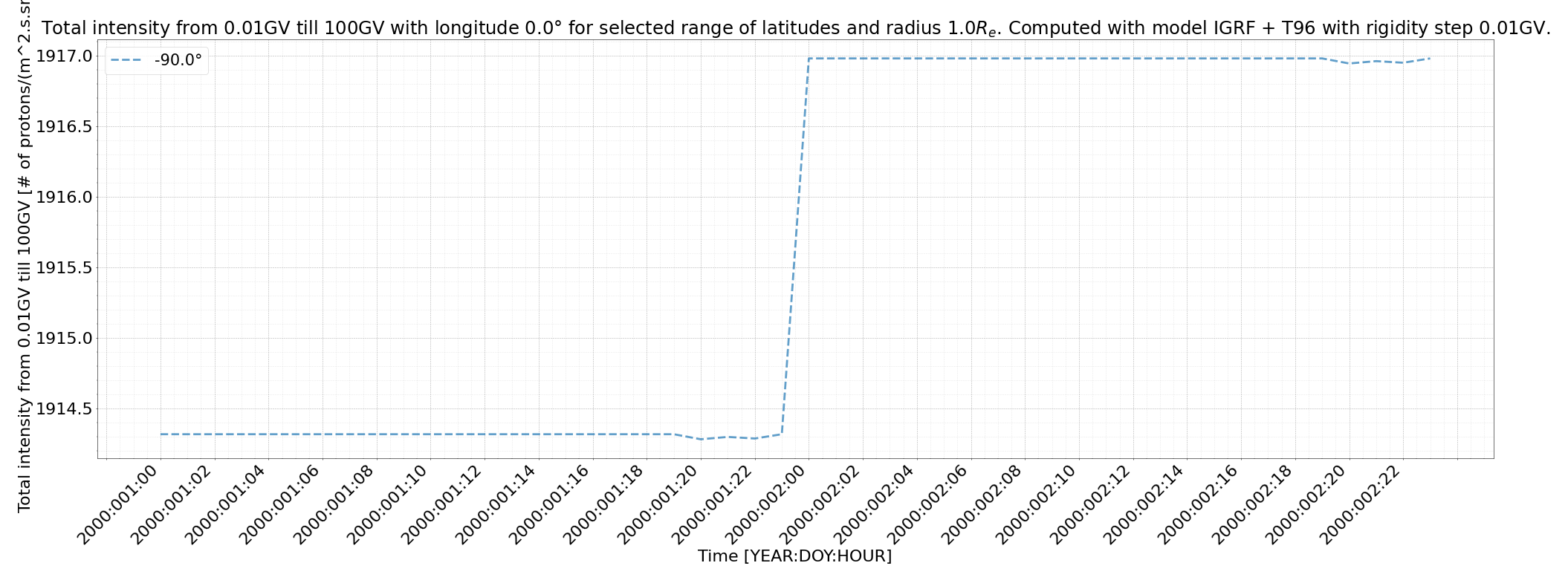
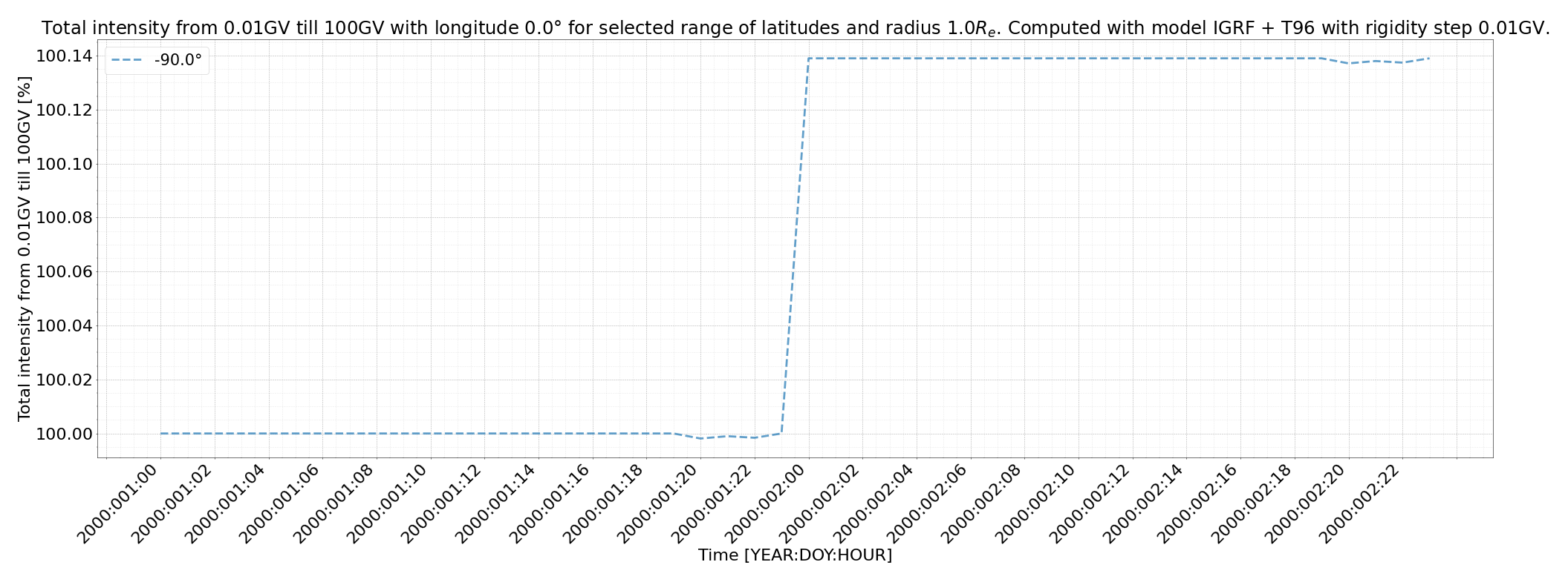
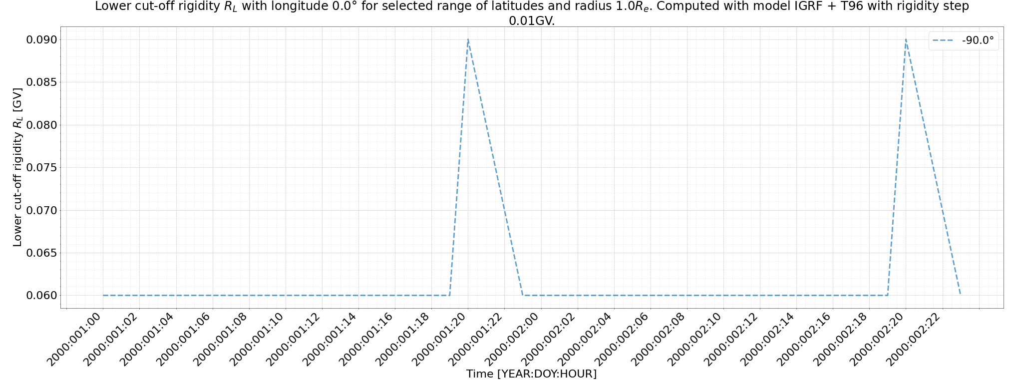
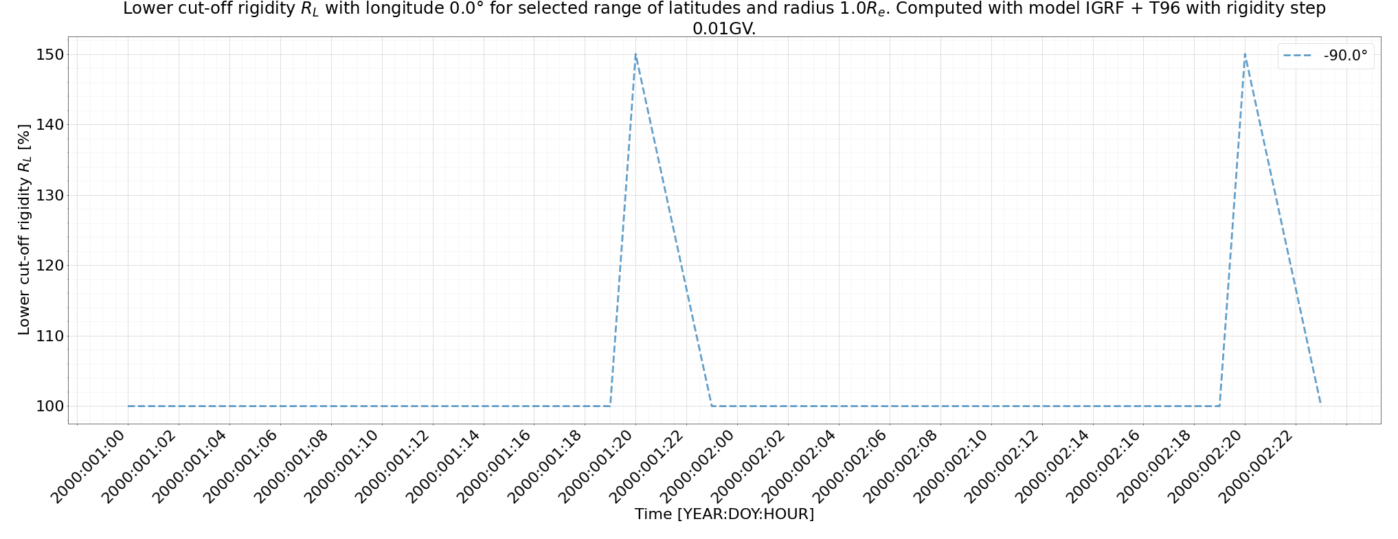
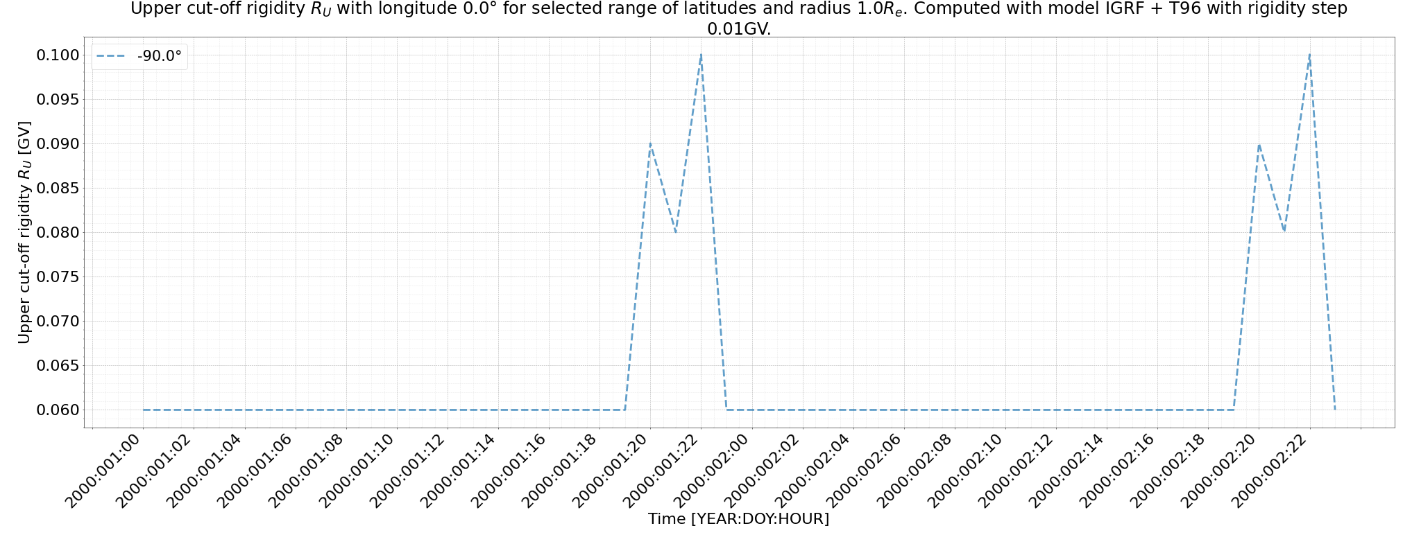
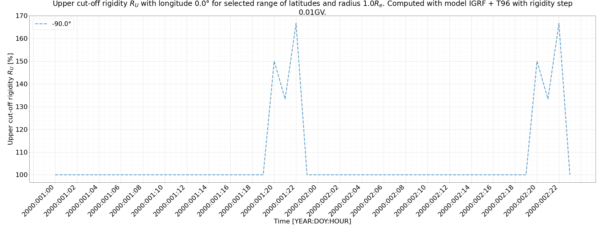
Input data that was used for this simulation.
First date-time: 2000-01-01 00:00:00
Last date-time: 2000-01-02 23:00:00
Time step: 1 Hour
First latitude: -90
First longitude: 0
Last latitude: -90
Last longitude: 0
Latitude step: 0
Longitude step: 0
Radius: 1 GV
Rigidity step: 0.01 GV
Number of directions simulated: 1
Runtime: 00:03:25.385
Optimization level: No optimization
Spectrum: Force field Usoskin JGR 2017
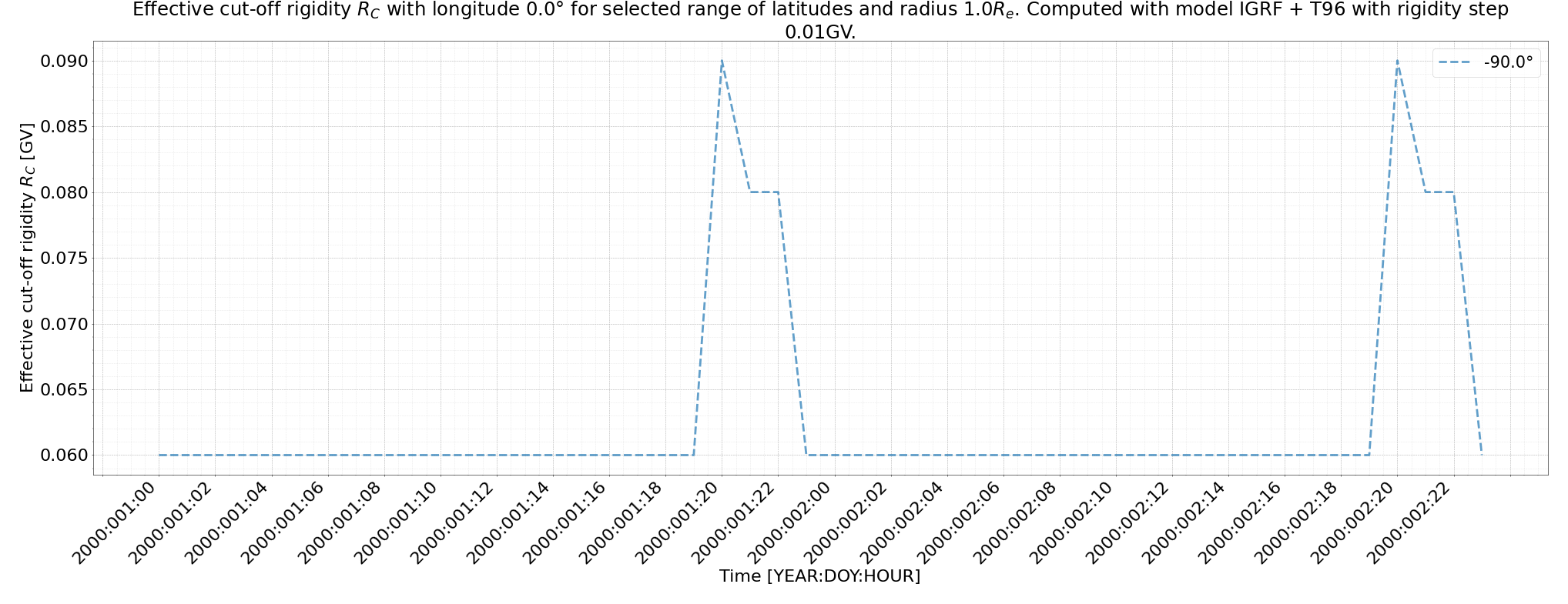
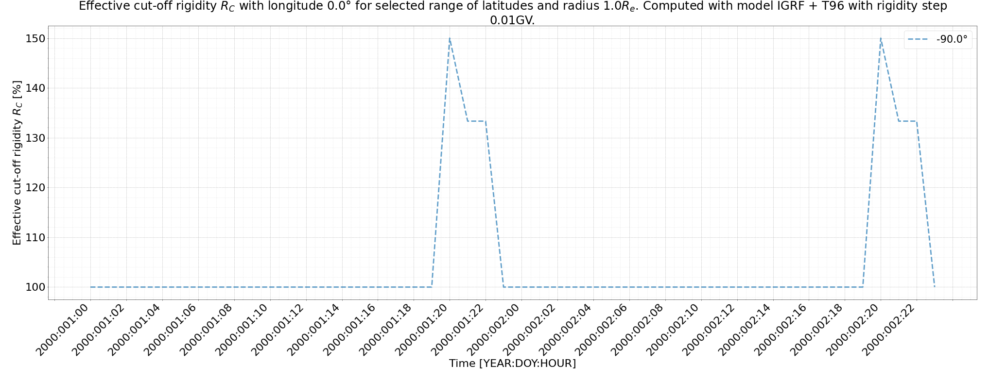
Be aware that on Windows you need to use software called 7-Zip to open .tar.bz2 archive. Be sure to use the newest version. 7-Zip version 19 contained a bug that would cause a failure when attempting to open tar.bz2 archives. We recommend using version 7-Zip 23.01.
Also, be aware that Windows has a limit on the length of paths to 260 characters. In some cases, files in batch simulations can have paths with 150 or more characters. This means that on Windows, you should not put results into paths that are 100 or more characters long already.